The Wysis Way Part 2 - Introduction
You are here: Home > Cotswold Blog > The Wysis Way Part 2 - Introduction
This is the second part of my blog about the Wysis Way, the Long-Distance Walk between National Trails the Thames Path, England and the Offa Dykes Path, Wales. The Wysis Way runs for 55 miles (88km), through the Cotswolds, Severn Vale, Forest of Dean and the Wye Valley. It provides a link to 400 miles of continuous walking from Greenwich in East London to Prestatyn on the North Wales coast.
In my Part 1 blog, I described the routes passage through the less visited places of the Cotswolds. This blog covers its onward route westwards, through the Severn Vale, Gloucester, and the Forest of Dean. Then south westwards through the Wye Valley to meet the Offa Dykes path at Monmouth in Wales. This time many of the places en-route are tourist attractions. However, I again take a deep dive into their history and aim to find associations with my previous blogs.
Route Overview
I ended my Part 1 blog at Painswick Beacon, at the edge of the Cotswolds escarpment. The remarkable thing about the next section of the walk is the summit-to-summit views of key landmarks, 12 miles apart. Painswick Beacon, Robinswood Hill and May Hill are all visible to each other, with summits approaching 1,000 feet (305m). The two dome shaped hills offer stunning 360-degree views and are also visible along a previous walk of mine, the Cotswold Way. So, they allow a look back at many miles of the Cotswold Ways route along the top of the Cotswolds escarpment.
Once en-route Gloucester, its stunning Cathedral, and the backdrop of the Malvern Hills provide a frequent reference point. Another highlight is the challenging 900 feet (275m) climb to the summit of May Hill from Gloucester. From May Hill the northern Forest of Dean is visible, and the route than passes through this crossing the border between England and Wales. At its western edge, stunning views of the Wye Valley and Brecon Beacons meet the eye. The world-renowned Symonds Yat is just a short divert from the route, then the whole of Monmouth can be viewed some 720 feet (220m) below the Kymin. This is a Hill with an historic roundhouse and naval Temple, both visited by the great Lord Nelson
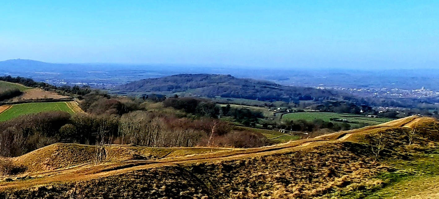
Robinswood Hill's dome rises to 651 feet (198m), and defines its surrounding Country Park, which has wildflower meadows, orchards, woodland and ponds that support a rich variety of wildlife. Its quarry is designated a Site of Special Scientific Interest (SSSI) given the layers of rock that date back to the Jurassic period. The geology contains:
- a significant inland section of Lower Jurassic, Middle Lias strata (199.6 million to 145.5 million years old)
- a complete section of the Upper Pliensbachian Stage (latter part of Jurassic Period
- ancient faunas, with fifty-four species of fossil molluscs recorded
The Domesday book refers to Robinswood Hill as Mattesdon, but it gets its present name from the Robins, a local Matson family who had rights to graze sheep here during the Elizabethan period. There are springs rising on Robinswood Hill that were originally one of the main sources of water to Gloucester, and records of its use at Gloucester Abbey date back to the 13th century. Reservoirs were built in 1837-8 to store and supply the springs water, though ceased use in 1946, and have since been infilled.
Today the site is the head office of Gloucestershire Wildlife Trust, who work closely in partnership with the park's owners Gloucester City Council. The Wildlife Trusts visitor hub has self-guided activities for all ages to pick up and use to explore the Hill.
Gloucester links to my previous blogs
The Wysis Way passes through the centre of Gloucester, and it is here that I have found associations to my other blogs. Firstly, a link to my William Morris blog provided by the Cathedral, and then to my Walking to the Thames Path (Cotswolds Canals) blog.
The Cathedrals association to my William Morris blog is through some of its stained-glass windows. One that depicts Saint Agnes holding a lamb was manufactured by Morris and Co from an original artwork by Edward Burne-Jones. There are also windows by Christopher Whall, who decided to learn the techniques of the Arts and Craft movement William Morris had pioneered. Whall was a rising star of the Arts & Crafts Movement in the 1890s, and he was commissioned to make the new windows for The Lady Chapel. The full article about this can be found here bsmgp.org.uk
The second link is the Gloucester and Sharpness Canal, completed in 1820, and once the broadest and deepest canal in the world. It connects Gloucester Docks with the Stroudwater Navigation at Saul Junction, as featured in my Walking to the Thames Path (Cotswold Canals) blogs. These explain that the Stroudwater Navigation, and then the Thames and Severn Canal, once provided a continuous route from the River Severn to the River Thames and London. And there are plans to restore that route.
The Wysis Way passes through Gloucester Docks, which evolved from the use of Quays on the River Severn from before 1390. The history of the docks dates from the late 1700s.
The Quays
A stone structure on the east bank of the eastern arm of the River Severn defines what later became the common river Quay. It was likely to have been built by the burgess community before 1390, and from 1454 was used for the disposal of refuse. A one-time quay is also recorded near St. Oswald's Priory around 1540.
In 1580 the common quay, known then as the king's quay, was designated the principal landing place in the new port of Gloucester, and the following year the city corporation built a custom house. In 1622 the corporation began constructing a second quay. Several inns, some called the ship, were opened from the 17th century. The earliest recorded in 1630 was called the Star. The late 17th / early 18th century saw several industrial buildings erected, notably a large conical glasshouse and a conical limekiln.
The number of vessels using the river quays declined by the 1840s, and the corporation's cranes had been abandoned by 1854. The quay's decline was accelerated by the expansion of the docks, the severing of the tramway to them and the silting up of the river foreshore. An attempt at major improvement of the city's river quay was made in 1887. However, Trade had ceased by the mid-1960s, and by 1986, the custom house was the only building to survive as a reminder of the trade once carried on the river's quays.
The Docks
The first stage in the development of Gloucester's docks was the construction of a basin to serve a planned ship canal, that would bypass the navigation obstacles on River Severn South of the city. Construction first advanced in 1783, though suffered engineering and financial problems. In 1799 the lock and basin were ready for use but work on the canal was halted. The basin was eventually opened to vessels from the river in 1812 and in 1817 work was resumed on the canal to join the Severn downstream at Sharpness (hence Gloucester to Sharpness Canal).
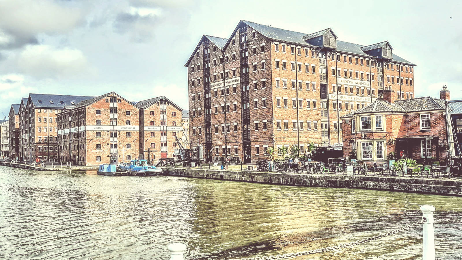
In 1826 the canal company began building the first of the large warehouses which were to be the dominant architectural feature of the docks. The other warehouses were added at intervals until the early 1870s by merchants for their own use or letting. The Docks today contains a mix of historic warehouses and modern buildings. More about the current Docks can be read and viewed here.
May Hill
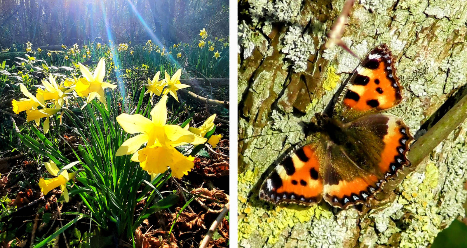
May Hill is also in the shape of a dome, which its summit at 971 feet (296m) above sea level. It offers incredible views of the Severn Vale and Cotswolds to the south and east, and the Forest of Dean, Herefordshire, Black Mountains and Malvern Hills to the east and north. It's a spiritual site hosting summer solstice celebrations.
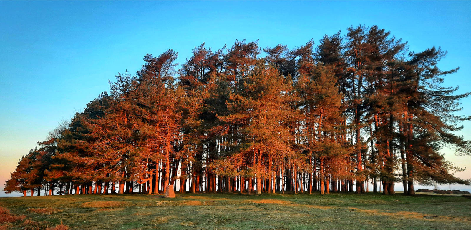
Its standout feature is a collection of mature Corsican Pines at its summit, that in addition to its shape, make it a notable landmark. Early maps, paintings and accounts show a clump of trees on the top before more recent plantings in 1887 to mark Queen Victoria's Golden Jubilee. There is one Scots Pine that is a generation older.
Geology
The geology sets Mayhill apart from the limestone of the Cotswolds. It is formed of sandstones and siltstones, and is part of the Huntley Hill and Yartleton formations. (It was formerly known as Yarlington Hill). These rocks date from the Early Silurian period (419 to 443 million years ago). Several faults run through the hill, the Blaisdon Fault being the most significant.
May Hill was designated a biological and geological Site of Special Scientific Interest (SSSI) in 1954, and is listed in the Forest of Dean Local Plan Review as a Key Wildlife Site.
Some history of May Hill from www.british-history.ac.uk:
- A glassworks was operated by French immigrants near the foot of May Hill in the latter decades of the 16th century
- In the 18th and 19th centuries squatter settlement on common and waste land created several hamlets, and substantial quarrying of stone took place on its sides. This supplied brickworks in Kempley, Newent, and Taynton.
www.visitdeanwye.co.uk adds the following about May Hill:
- It has an Iron Age circular trench 100 m in diameter, with a round barrow within it
- It was often used as a beacon to ships navigating the River Severn and, consequently, the trees were used for these beacons
- It has been said that from some angles the trees look like a ploughman and his team. John Masefield describes it in his poem "The Everlasting Mercy"
- May Hill is associated with the Poets Edward Thomas, Robert Frost. Ivor Gurney eulogised "May Hill that Gloucester dwellers 'gainst every sunset see"
- Prince Rupert and some of his Cavaliers took shelter amongst the trees for a short time during the siege of Gloucestershire in 1643
Today, May Hill Summit is vested in Longhope Parish Council the sole trustee of the May Hill Trust. The Common around the summit is owned by the National Trust, and still grazed by free to roam ponies, pigs and sheep. It is the location of annual May Day celebrations, with Morris Dancers and hundreds of observers celebrating from dawn.
Forest of Dean and Symonds Yat
In medieval times the Forest of Dean was a royal hunting forest, and later a source of timber for the navy's Tudor warships. In Victorian times major industry took precedence, with coal mining and tramways, the routes of which appear evident today. In 1938 it was designated a National Forest Park, and today produces sustainable timber for the UK market as well as being popular with tourists. The Wysis Way passes through Micheldean, Brierley and Hillersland, with Symonds Yat rock only a 25-minute walk from the latter. A standout feature is The Everard Oak, near Staunton which towers above other trees. Just past the border with Wales, it marks the start of the transition into the Wye Valley. (Shown in this blogs cover picture, the Everard Oak is the bare tree top left)
There are at least nine iron age hilltop enclosures dotted along the lower Wye Valley. These earthworks, constructed between 700BC - 43AD. At Symonds Yat the hillfort was defended on two sides by steep cliffs and on the third by five concentric ramparts, each a substantial bank with a ditch alongside. More can be read here.
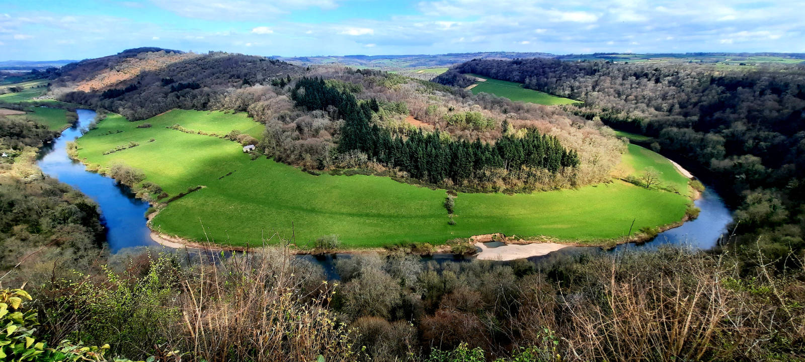
Symonds Yat Rock is an internationally renowned viewpoint with iconic views of the Wye Valley as the River Wye meanders around a headland with cliffs and a rocky outcrop. For the last 200 years visitors have come to the area to view its picturesque landscape, including famous poets, writers and artists. Among these literary greats were Pope, Coleridge, Wordsworth, Thackeray and Turner, who embarked on the 'The Wye Tour'. More Modern literary connections include J.K Rowling, since the area is a film location used for Harry Potter and the Deathly Hallows Part 1. Today the viewpoint offers views down both sides of the valley, along the cliffs and down to the village below.
The Kymin
The hill east of Monmouth is called The Kymin. It has been known locally as a picnic spot since the late 18th century when it was frequented by members of the Monmouth Picnic Club. The Round House, which features a castellated top, was erected in 1794 as a banqueting venue for the club. Lord Nelson had breakfast here with Sir William and Lady Hamilton in August 1802. Its views over the Wye Valley are breath-taking.

The Naval Temple nearby was built in 1800 by public subscription. It features a statue of Britannia sitting on her customary rock, a traditional symbol of British strength and unity. Stone carvings depict Lord Nelson's first commission and his victory at the Battle of the Nile.

Wye Bridge
The Wysis Way ends in Monmouth at the stunning grade 2 listed Wye Bridge. Records show a bridge may have existed at this site in 1282, and its clear a previous wooden bridge was built in the fourteenth century. This was completely rebuilt in stone in the early seventeenth century (1615-17), collecting tolls from those crossing the bridge. A plaque on the parapet records the widening of the bridge, retaining the original arches on both sides, in 1878-80 under the architect Edwin Seward of Cardiff. Its total span is 233 feet (71m), with five arched spans with the original pointed arches visible beneath, and sharply pointed cutwaters.
Final Impressions
In my first blog, my summary denounced critics saying there was nothing of note on the Wysis Way. I explained how the places along the route have history dating back to the stone age, links to the Arts and Craft movement, and some military history. This second part of the walk also far exceeded my expectations, and I felt critics and some common sources missed the value or significance of the following:
- Further iron age structures at Symonds Yat and May Hill
- Geology dating back to the Jurassic and Early Silurian period i.e. 443 million years ago
- Gloucester too has links to the Arts and Craft movement and Cotswold Canals
- May Hill and Symonds Yat have associations to world famous writers and poets
- Stunning scenery that fully justifies the phrase 'blessed is the eye between the Severn and the Wye'
- Some naval and nautical history - it's quite humbling to know you are stood in the shoes of the greatest officer in the history of the Royal Navy, when looking down on the Wye Valley and Monmouth.
As a final observation I started my Wysis Way journey by seeing its signs while searching for the abandoned Cotswolds Canals and the source of the River Thames. Most common sources simply describe it as a functional walking route between more notable National Trails. However, I hope I have shown that, it is embellished with rich and ancient history, golden and green scenic views, and incredible associations with Arts and Crafts and Literary greats.
Last updated: 23 August 2023 - Please note: This blog was first written over a year old and things may have changed since the blog was written.